

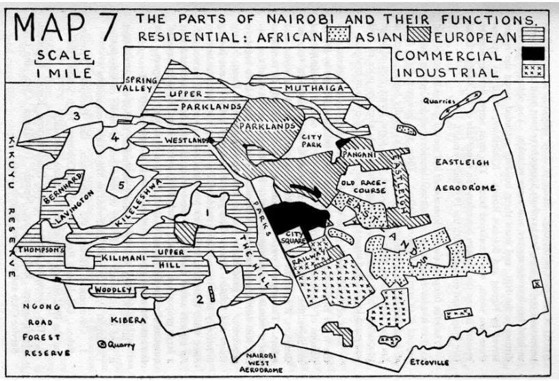
When Nairobi was first incorporated on April 16, 1900, as a basic railroad township, the colonial administration immediate moved to establish strict legal control over the chaotic settlement. Using early public health ordinances and municipal rules as a convenient legal tool, British planners deliberately divided the expanding town into tightly restricted, racially segregated zones. This state-sanctioned spatial partition laid down the exact geographic dividing lines that still shape our modern commute.
The regulations systematically split the city by race and class. The vast plains to the east and south of the railway line, characterized by non-porous black cotton soil that flooded heavily during rainy seasons, were designated for the African workforce and labeled as Eastlands. Meanwhile, the higher-altitude northern and western zones, blessed with rich, well-drained volcanic red soils, were legally reserved for European residential estates, paving the way for exclusive suburbs like Parklands and Westlands.
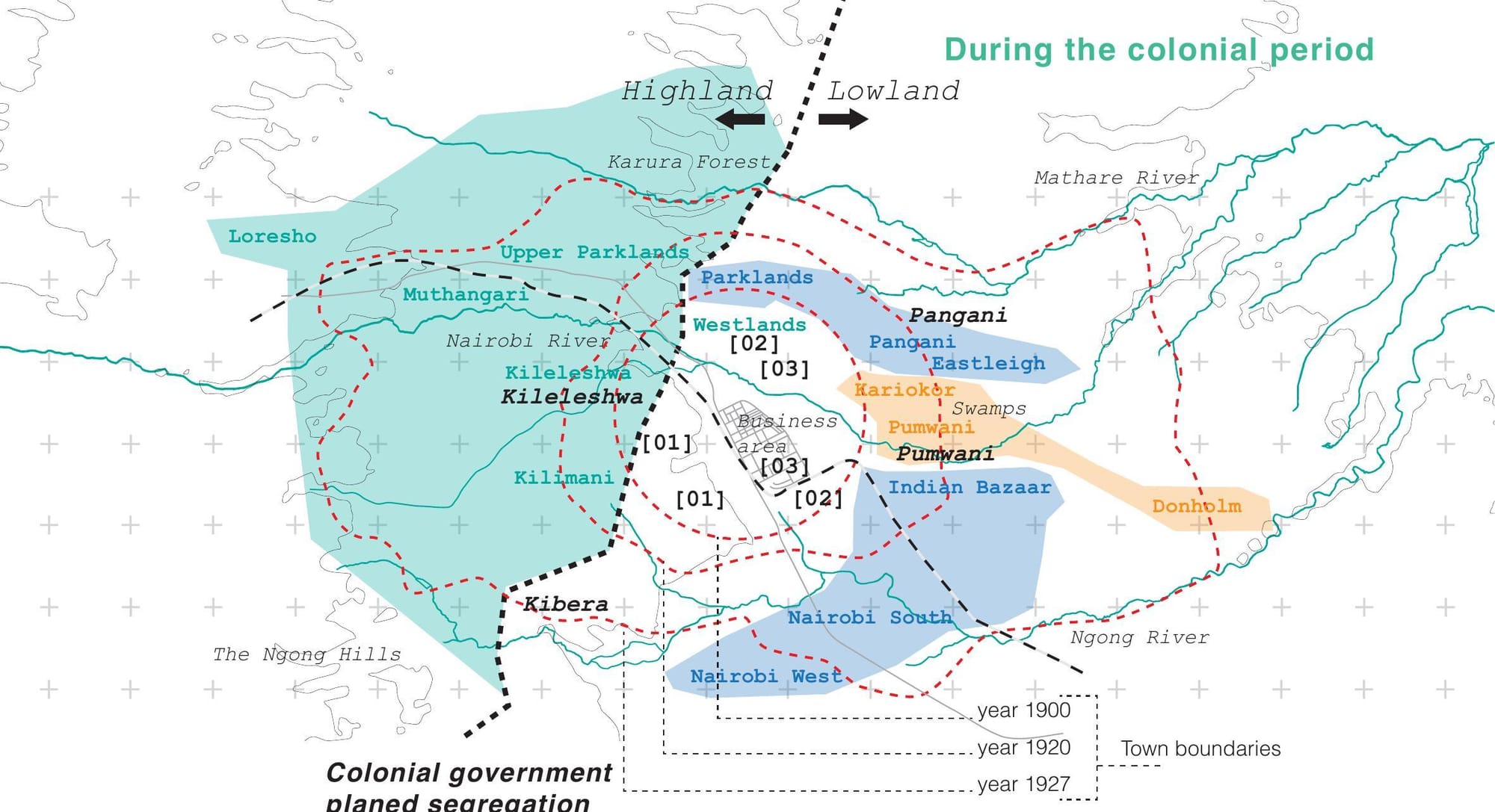
By pushing industrial operations and laborer housing down into the eastern plains while anchoring luxury estates up in the breezy western ridges, early administrators permanently dictated the city’s wealth distribution.
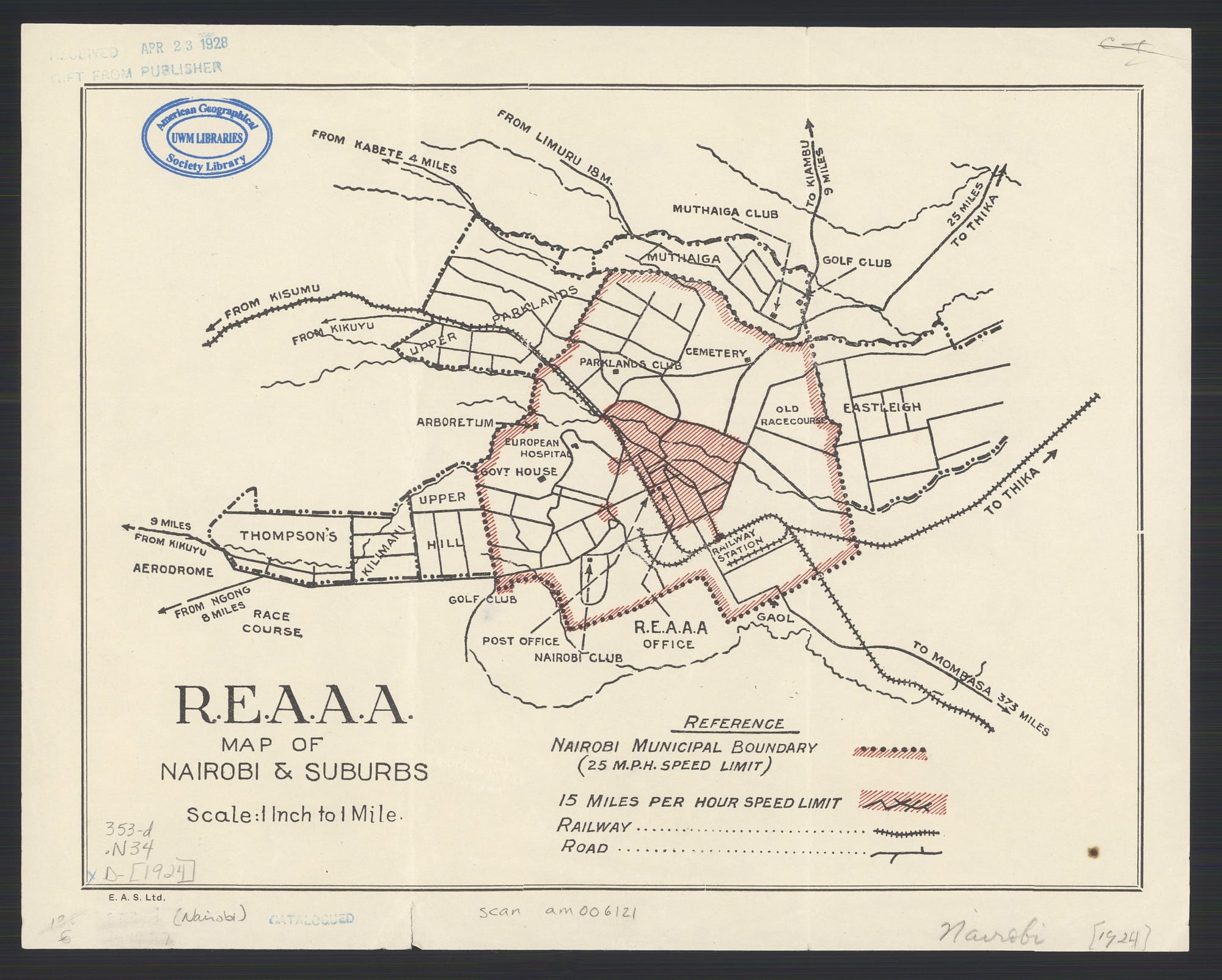
Unpacking the history of Nairobi colonial zoning laws reveals how early 1900 Nairobi municipal regulations institutionalized the sharp Eastlands vs Westlands history that continues to impact property values across the county today.